Geo Canvas v.0.19
Advertisement
Description
The Geocanvas project aims to provide a very small and simple set of APIs toassist the developer in creating geographically referenced canvas applicationswithin the GTK/Gnome environment.
- Rate:
- License:Freeware
- Category:Science
- Developer:geocanvas.sourceforge.net
- Downloads:72
- Size:547 Kb
- Price: Free
To free download a trial version of Geo Canvas, click here
To visit developer homepage of Geo Canvas, click here
Advertisement
System Requirements
Geo Canvas requires Mac, Windows, Linux.
Geo Canvas v.0.19 Copyright
Shareware Junction periodically updates pricing and software information of Geo Canvas v.0.19 full version from the publisher using pad file and submit from users. Software piracy is theft, Using crack, password, serial numbers, registration codes, key generators, cd key, hacks is illegal and prevent future development of Geo Canvas v.0.19 Edition. Download links are directly from our publisher sites. Links Geo Canvas v.0.19 from Bittorrent, mediafire.com, uploadfiles.com, hotfiles.com rapidshare.com, megaupload.com, netload.in, storage.to, depositfiles.com and other files hosting are not allowed. The download file is obtained directly from the publisher, not from any Peer to Peer file sharing applications such as Shareaza, Limewire, Kazaa, Imesh, eDonkey, eMule, Ares, BearShare, Overnet, Morpheus, BitTorrent Azureus and WinMX.
Review This Software
More Geo Canvas Software
Advertisement
Geo Data German Admin v.15.00
The database contain geodata of the Federal Republic of Germany with geo referenced towns, municipalities, town quarters, administrative units, postal codes, telephone preselections, nature areas, landscapes, climatic zones for proximity searches ec.
Plastic Canvas Design Studio v.2.0.05
Plastic Canvas Design Studio allows you to design your own plastic canvas projects using your computer. Its tools help you create projects from scratch, or you can convert your favorite graphics.
LimitState:GEO v.2.0.6
LimitState:GEO is the revolutionary geotechnical stability analysis software that can be used to rapidly determine the critical failure mechanism and margin of safety for any type of problem, including those involving: * slope stability * retain
Geo Gizmo 3D Screensaver v.1.0
Welcome to the nanoworld of the Pixel Paradox universe of 2099 AD. Geo Gizmo is a pollution-free nanodevice that acts as a perpetual-motion machine to generate electricity from artificial gravitons in motion above a quantum energy plate,
Photos On Canvas Print calculator v.1.00
Photos on Canvas Printing quality Calculator - use this completely FREE and elegant solution in order to calculate the quality you will get when printing your digital pictures on canvas. According to target size, calculate the resulting quality. This

Canvas Shoes Theme for Page Turning Book v.1.0
Canvas shoes is named from its material canvas, now it is a worldwide popular shoes style especially popular among young people.
Canvas GIS Advanced (Mac) v.9.0.4
About Canvas GIS Advanced (Mac)Adds native support for Geographic Information System (GIS) data to Canvas.
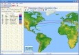
GEO Spider
Now you can trace your network activity on world map. GEO Spider helps you to trace, identify and monitor your network activity on world map. You can trace any website or IP address. Whois reports give to you more info about site, host, domain, ip
Canvas 11
Canvas 11 is the single most cost-effective, integrated solution for the creation, enhancement, presentation and sharing of technical illustrations and graphics. If you work with technical illustrations and graphics, you know how daunting the task can be
Geo Data International Streets
For many countries street coordinates are present with coverage degrees of 100 percent. The geo data offered here are in high-precision quality and are present in several coordinate and reference systems (Geographic, UTM / WGS84, ETRS89). Street
Geo Data International Houses
For many countries house coordinates are present with coverage degrees of 100 percent. The geo data offered here are in high-precision quality and are present in several coordinate and reference systems (Geographic, UTM / WGS84, ETRS89). House Coordinates